Road Race Course Analysis: Plan, Pace, and Execute
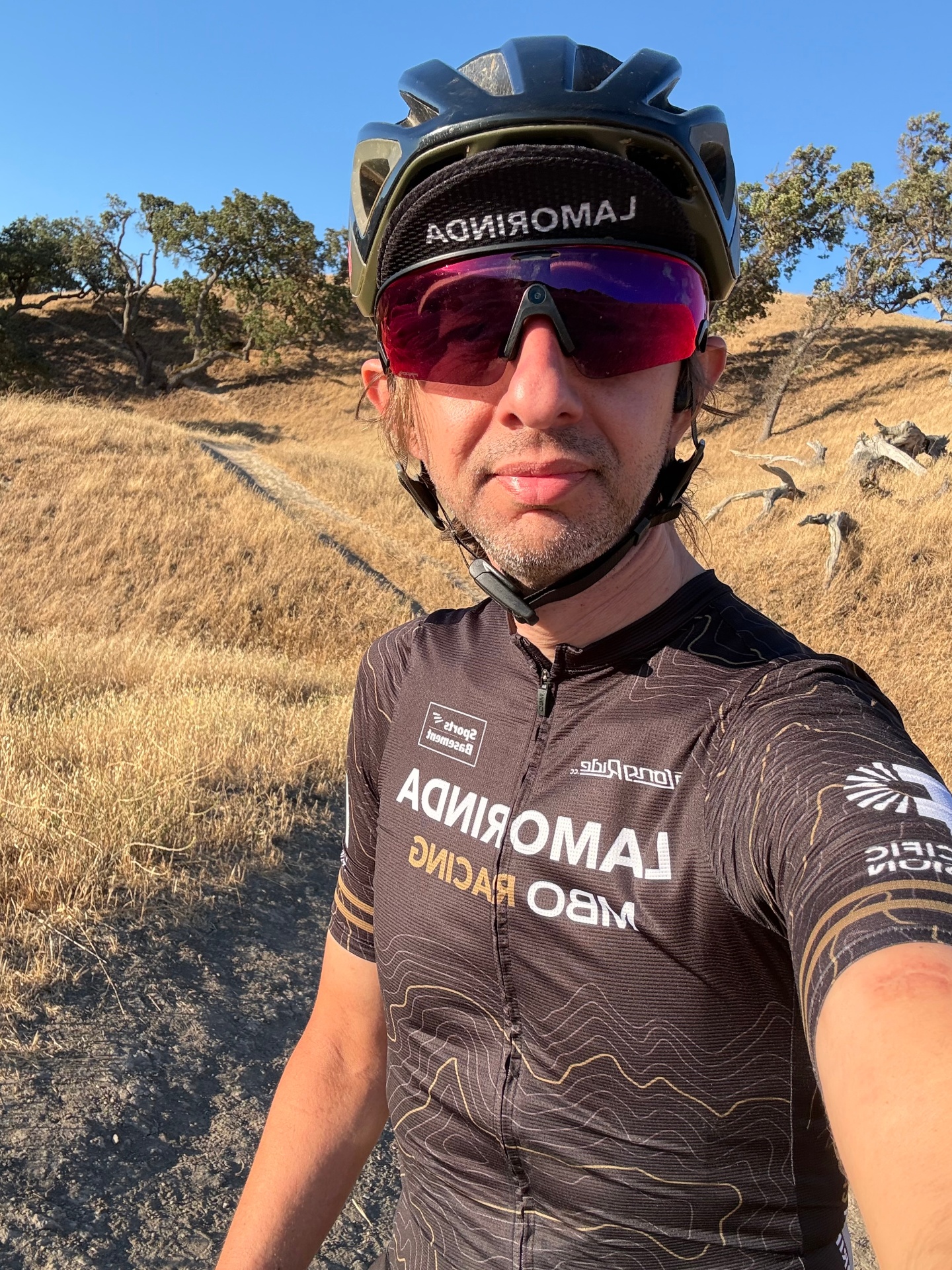
Gabriel Ricce
Lamorinda MBO Racing · USA Cycling Coach Level 3

Analyze the course by dividing it into elevation, wind, surface, technical, aid-station, and finishing segments. Assign an effort cap, fueling cue, position goal, and contingency to every decisive section. Use the newest official map first, verify it against a current GPX file and street-level imagery, then rehearse the opening, hardest segment, and final kilometers. This converts a route from a line on a map into a pacing and execution plan. The guidance below includes discipline-specific notes for cycling road races and road running, because both reward the same preparation even when equipment and tactics differ.
Why course analysis wins road races
Fitness creates capacity; execution decides how much of it reaches the finish. Course analysis replaces generic pacing with a segment-by-segment plan. When you map elevation, surface, turns, exposure, and aid stations, you know where to protect energy and where the course justifies spending it. Your splits then reflect strategy rather than guesswork. The Endurance Race Guides show how this approach fits into complete race preparation.
Elevation dictates effort. Short, punchy climbs call for controlled power or pace. Long drags reward steady output and patience. Descents can provide low-cost speed when you have already planned cadence, line choice, and—when running—footstrike.
Wind exposure, camber, and road width influence drafting and position in cycling and group shelter in running. Tight corners interrupt rhythm and force accelerations. Knowing where aid is available lets you time bottles, gels, and sodium before hard segments rather than while you are already under pressure.
Surface matters too. Concrete can feel harsher than asphalt; cobbles, paint, metal covers, and bridge plates lose traction when wet. Landmarks create a mental script: settle, check, commit, and close. Arriving with those decisions made reduces cognitive load when fatigue rises.
Get the right data before you start
Start with the event's official course map and elevation profile. Confirm distance, start and finish locations, current-year route, certified-course status, road closures, construction notices, feed zones, and aid-station services. Use the Race-Day Checklist to close logistical gaps.
Import the route into a reliable mapping platform such as Strava Routes, Garmin Connect Courses, Ride with GPS, or Plotaroute. Compare total gain, maximum grade, and the location of climbs and descents against distance markers. Mapping services smooth elevation differently, so use the profile to find trends rather than treating every meter or foot as exact.
Use satellite and street-level imagery to inspect lane width, surface quality, camber, narrow bridges, roundabouts, turn radius, and likely bottlenecks. Pull historical weather for the event's time of day, then save a 72-hour forecast alert for race week. Overlay wind direction on the course and note shade, sun exposure, and heat-prone concrete. The guide to race-day weather and conditions provides a framework for those decisions.
Record exact aid locations and what each station supplies. Flag any gap longer than 3–5 mi (5–8 km), timing mats, out-and-back traffic, neutral zones, and sections where crowding changes the usable line. If sources conflict, follow the newest official event document or organizer notice.
| Data source | What to verify | How to use it |
|---|---|---|
| Official map and athlete guide | Current route, closures, aid, rules | Establish the authoritative course |
| Current GPX or TCX | Distance, elevation trends, turns | Build watch cues and segment splits |
| Satellite and street view | Surface, width, camber, obstacles | Select lines, tires, footwear, and position |
| Historical and race-week weather | Wind, temperature, humidity, rain | Adjust pacing, hydration, gear, and handling |
| Recent race reports | Congestion and practical hazards | Validate details the map cannot show |
Break down elevation: climbs, rollers, and descents
Total elevation gain is only a headline. Where the gain occurs determines pacing, fueling, and how your legs will feel late in the race. Plot elevation against distance and mark the start, crest, length, average grade, and location of every meaningful climb.
Climbs: Flag sustained pitches above roughly 2–3% for 400–800 m (0.25–0.5 mi) or longer, plus any short wall that forces a major change in output. Note whether the climb follows a flat approach or accumulated climbing. Set a power, heart-rate, or RPE cap. Accept slower speed as the cost of maintaining sustainable effort. If the crest feeds into a false flat, continue the planned effort for about a minute before settling.
Rollers: Repeated short rises reward smooth output. Ease into each rise, prevent an unnecessary power or pace spike, and use gravity on the back side without sprinting. When rollers arrive late, move a carbohydrate and fluid dose earlier; repeated accelerations become more expensive as glycogen falls.
Descents: Record grade, length, surface, wind, sight lines, and the feature immediately after the descent. Cyclists should choose a safe line and braking point before the corner. Runners should use quick turnover and avoid overstriding or pounding the quadriceps. A descent into a sharp turn, narrow bridge, or aid station needs more margin than an open straight.
Assign each segment an effort zone and a simple cue such as smooth power, quick feet, relaxed shoulders, or fuel before the climb. Rehearse transitions from climb to crest to descent instead of treating them as unrelated pieces. More examples are available in the Endurance Race Guides.
Wind and weather: the invisible gradients
Wind can add a hidden climb that never appears on the elevation profile. Pull the hourly race-morning forecast and place wind arrows on the route. On point-to-point courses, identify long sections aligned with the forecast. On loops, mark every change from headwind to crosswind or tailwind.
Race by effort rather than speed into a headwind. Use RPE, heart rate, or power to prevent an early surge. Cyclists should reduce frontal area only in a position they can control and sustain. Runners can shorten stride slightly, keep cadence smooth, and relax the shoulders. With a tailwind, hold planned effort instead of banking time too early. In crosswinds, identify legal shelter and move into a safe position before the road becomes exposed.
Temperature, humidity, precipitation, and wind interact. Warm humid conditions raise thermal strain even when speed feels low. A tailwind can reduce convective cooling. Wet roads and gusts make paint, metal, and off-camber turns more hazardous. Extend braking or deceleration zones and use the cleanest predictable line.
Write a wind script by distance: expected direction, effort cap, positioning goal, and contingency. If race-morning conditions differ, update only the affected segments during warm-up. Treat wind as measurable terrain, not a surprise. See race-day weather and conditions for the full planning framework.
Road surface, obstacles, and technical features
Map smooth asphalt, chip seal, concrete, cobbles, patched pavement, gravel connectors, and construction zones. Every transition can change rolling resistance, traction, comfort, and cadence. Test tire or shoe choices on comparable surfaces before race week.
Scan for road crown and camber. A long side slope loads the body asymmetrically; choose a more neutral line when it is safe and legal. Mark potholes, utility cuts, speed humps, paint, drainage grates, metal plates, trolley tracks, curbs, cones, and lane shifts. Wet paint and metal are especially slick.
Classify turns by radius, approach speed, camber, exit width, and what follows. Frequent tight turns cost momentum. In cycling, brake before the turn, look through the exit, and accelerate smoothly only when the bike is settled. In running, use short, quiet steps and avoid a hard surge on every exit. Downhill or off-camber turns deserve a wider safety margin.
Pinch points compress the field. Decide where position matters and where patience saves more energy than fighting for space. Annotate the map with hazard icons, safe lines, and short cues. Build two or three rehearsal sessions on similar terrain, then use the Race-Day Checklist to confirm the final setup.
Mark the critical points that decide results
Circle every feature that forces a decision: the longest climb, steepest pitch, exposed straight, technical descent, narrow sector, feed zone, final turn, and last kilometer. Give each one a role—selection point, recovery zone, pacing trap, fueling window, position fight, or finishing move.
| Critical point | Decision to make before race day | Execution cue |
|---|---|---|
| Major climb | Effort cap and position at the base | Hold output; continue over the crest |
| Technical turn | Entry speed, line, and exit width | Slow early; accelerate after the exit opens |
| Surface change | Tire or footwear choice and safe line | Relax; keep traction predictable |
| Exposed wind zone | Position and power or RPE ceiling | Find legal shelter; ignore speed |
| Aid or feed zone | Product, quantity, and pickup side | Fuel on stable terrain before hard work |
| Final 1–2 km | Launch marker and backup move | Protect position; commit at the cue |
Place intake where effort and handling are stable. Avoid grabbing a bottle immediately before a technical turn or in the middle of a hard climb. Sync carbohydrate, fluid, and sodium cues with the race fueling and hydration plan. Note early bottlenecks and narrow lanes so you know where to be assertive and where waiting preserves energy.
Map the final 1–2 km (0.6–1.2 mi) in detail. Record every rise, bend, narrowing, surface change, and wind corridor. Pick a primary launch marker and a backup for a slower or faster race. A finish plan must be specific enough to execute when judgment is tired.
Convert analysis into pacing, fueling, and hydration
Turn the annotated map into a one-page plan. Divide the route by terrain and exposure rather than arbitrary distance alone. Use pace targets on stable ground and effort, heart rate, or power where wind, heat, elevation, or congestion makes speed misleading.
| Course condition | Pacing response | Fueling and hydration response |
|---|---|---|
| Early uphill or headwind | Hold 3–5% below an aggressive target; cap surges | Fuel before the segment; use small sips |
| Rollers or repeated turns | Smooth effort and regain speed gradually | Choose easy-access carbs; avoid eating mid-corner |
| Long steady flat | Settle at target effort and monitor drift | Use the main drinking and fueling window |
| Hot exposed sector | Lower pace or power if HR/RPE rises | Increase planned sips and cooling; follow tested sodium needs |
| Final sheltered or downhill third | Build only if still inside the effort cap | Finish scheduled intake before the decisive move |
Start carbohydrate early. A practical example is 20–30 g every 20–25 minutes beginning in the first 15–20 minutes, adjusted to the athlete's tested hourly target and event duration. Move a dose earlier when the next aid station sits on a climb or technical sector. Use familiar gels or chews before rough sections when carrying solid food is awkward, and sip drink mix on steady roads. Carry a backup when published aid spacing is uncertain.
Convert weather and exposure into fluid and sodium targets using training data. Small, regular sips are usually easier to tolerate than occasional large boluses. Increase access before long sunny or windy stretches; reduce volume modestly in cool conditions without abandoning the plan. If race day is hotter than forecast, add fluid and cooling within practiced limits. Never force intake beyond thirst and gut tolerance merely to hit a number.
Practice the exact order—pace cue, bottle, carbohydrate, turn, climb—on similar terrain. The race fueling and hydration plan can help organize those cues.
Bike, wheels, tires, and gearing for the course
For cycling road races, match equipment to the profile, wind, surface, and your handling ability. Fit and control matter more than a theoretical aerodynamic gain.
Bike: An aero road setup suits flat, fast, and moderately rolling courses. A lighter climbing setup becomes more useful with sustained gradients above about 5% and frequent accelerations. Use the position you can hold at race intensity.
Wheels: Deep rims around 50–65 mm can be fast on steady roads but create more steering torque in crosswinds. Mid-depth 35–50 mm wheels are a versatile option for rolling profiles. Shallower wheels can improve control for lighter riders, gusty descents, or highly technical courses. Test the actual wheel choice in wind.
Tires: On clean tarmac, many riders choose 26–28 mm road tires. Rough chip seal or broken pavement may favor 28–30 mm or wider if the frame and rim allow it. Set pressure from rider mass, measured tire width, surface, weather, and manufacturer limits. Verify that the rim and tire combination is compatible, especially with hookless systems.
Gearing: Select the smallest climbing gear from the steepest sustained pitch and the cadence you can maintain under fatigue. A compact or subcompact crank with an 11–32 or 11–34 cassette suits many hilly routes; rolling terrain may suit 52/36 with 11–30; a fast flat course can use a tighter cassette. Smooth cadence is more valuable than an unnecessarily large top gear.
Complete a shakeout on representative terrain, then review equipment with the Race-Day Checklist.
Scenario planning: solo, break, or bunch sprint
Cyclists should build three mini-plans and know the course cue that activates each one.
Solo move: A late solo effort is more plausible when the final 10–20 km (6–12 mi) contain crosswinds, rollers, narrow roads, or technical turns that disrupt a chase. Mark a launch window after a hard sector or crest and define the sustainable power or effort to the finish. Front-load nutrition because eating becomes harder once committed.
Breakaway: Lumpy terrain, headwinds or crosswinds, repeated turns, and limited team control can favor a break. Identify selective points in the first hour and the teams likely to chase. Use smooth, short rotations rather than surging. Decide in advance when a shrinking gap means cooperation has failed and when a useful gap justifies investment. Fuel in protected pockets before technical sectors.
Bunch sprint: Wide, flat finishes with a tailwind or protected boulevard favor the group. Scout the final 3 km (1.9 mi) for lane count, road furniture, bends, camber, and wind corridors. Mark 3 km, 1 km, and 200 m anchors plus the preferred side of the road. Position into the last corner usually matters more than a perfect peak-power number.
Runners can apply the same framework as solo pace, committed small group, or pack finish. Preselect the feature where you will stop following and start racing. The Endurance Race Guides provide more event-planning examples.
Recon and execution checklist
- Download the current official map, profile, rules, and aid-station details.
- Cross-check the route with a recent GPX or TCX file and current organizer notice.
- Mark climbs, descents, rollers, turns, camber, surfaces, bridges, and narrow sections.
- Overlay forecast wind, sun exposure, shade, temperature, humidity, and rain risk.
- Assign effort caps, split ranges, positioning goals, and short cues to each segment.
- Place carbohydrate, fluid, and sodium timing on stable sections before major demands.
- Drive, ride, run, or virtually preview the start, hardest sector, and final 2–3 mi (3–5 km).
- Test the chosen bike setup, tires, wheels, footwear, bottles, and wrappers on similar terrain.
- Load the route and alerts into the watch or head unit; carry a simple backup cue card.
- On race morning, update only the variables that changed and keep the core plan intact.
Seed correctly, keep the opening controlled, use legal tangents, and execute intake on the marked cues. Review the full Race-Day Checklist before packing.
Related reading and tools
- Course preparation: Endurance Race Guides and the Race-Day Checklist.
- Conditions: Race-day weather and conditions.
- Nutrition: Race fueling and hydration plans.
- Mapping tools: Strava Routes, Garmin Connect Courses, Ride with GPS, Plotaroute, MapMyRun, satellite imagery, and street-level imagery.
- Weather tools: An authoritative local forecast plus Windy, Meteoblue, or myWindsock for route orientation and wind context.
Treat third-party profiles and forecasts as estimates. The newest organizer document remains the source of truth for the route, rules, and services.
Next steps
Choose the target event and download its newest official map and elevation profile. Mark the climbs, turns, aid stations, exposed sectors, surface changes, and final kilometers. Preview the route in person or virtually. Build a segment-by-segment pacing plan, attach fueling and hydration cues, and test it in one or two key workouts on comparable terrain.
Refine the plan from what actually happened in rehearsal, then share the one-page version with a coach, teammate, or support crew. Load the route and cues into your device, but carry a simple backup. Course analysis is complete when each decisive feature has a default action and a contingency.
Frequently asked questions
How do I get a reliable road race course map?
Use the current official event map or certified-course document first, then compare it with a recent GPX file and organizer notices. Crowd-sourced routes can reveal detail, but they should not override the newest official source.
What elevation details matter most on a road course?
Record the location, length, average and maximum grade, approach, and exit of each meaningful climb—not only total gain. A short steep rise late in the race can be more decisive than a long gentle climb early.
How should I estimate pace or power on hilly segments?
Use training on a similar grade and duration to set a power, heart-rate, or RPE ceiling. Let speed fall on the climb, keep effort controlled over the crest, and use the descent without forcing an unsafe surge.
Should I drive, ride, or run the course before the race?
Previewing the route is useful when it is legal and safe. Prioritize the start, hardest climb, technical sectors, and final 2–3 miles (3–5 km); a virtual preview is a practical alternative when travel or road access is limited.
How do I factor wind into a road race plan?
Overlay the forecast wind direction on the course and mark headwind, tailwind, and crosswind sectors. Use effort rather than speed into a headwind, choose safe legal shelter in crosswinds, and avoid overpacing with a tailwind.
How should road surfaces and turns change my plan?
Mark concrete, chip seal, cobbles, paint, metal, camber, and tight or downhill turns. Choose equipment and lines for traction, slow before technical turns, and regain speed progressively after the exit opens.
How should fueling and hydration adapt to the course?
Place carbohydrate and fluid intake on stable sections before long climbs, exposed roads, or decisive late efforts. Confirm aid-station spacing, carry a backup when gaps are uncertain, and adjust fluid and sodium from tested sweat data rather than a universal target.
What authoritative sources support course-based pacing and fueling plans?
Course authority should come from current organizer maps and certified-route documents. Pacing and nutrition principles are supported by Abbiss and Laursen's 2008 pacing review and the 2016 ACSM, Academy of Nutrition and Dietetics, and Dietitians of Canada position statement on nutrition and athletic performance.
Turn this strategy into a real plan.
FuelQ Pro builds personalized fueling for your training weeks, long rides and races — plan, execute, review, improve.